
Exposure is outpacing capacity
Industrial cities, logistics hubs and giga-projects are adding complex risks faster than any engineering team can visit, review and revisit them.
Pilot now open to Property & Casualty insurers
Virtrix is a physical risk intelligence platform that tracks how risk is changing at every site you insure and across your portfolio, so you can price, accept and reinsure with confidence.
The gap starts at the individual site and carries through to the balance sheet
Industrial cities, logistics hubs and giga-projects are adding complex risks faster than any engineering team can visit, review and revisit them.
Risks cluster in ports, industrial zones and economic cities. Without a site-level view, shared-event exposure stays hidden until a loss reveals it.
Flash floods, extreme heat and dust events are testing assumptions built for a drier, calmer past.
Locations, occupancies and values arrive as declarations. When they are outdated or approximate, every model built on top of them inherits the error.
New buildings, storage yards and neighbouring hazards appear mid-term, yet the file still shows last year's picture.
Risk-based capital expectations and treaty partners increasingly ask for exposure figures they can trace back to evidence.
Each module reads the same record for a site: what the satellite shows, what your engineers confirm on the ground, and what underwriting, portfolio and reinsurance teams decide
Roof area, gaps to neighbours, open storage, nearby hazardous operations and access, measured from licensed imagery and confirmed by your engineer.
Two views. At each site: risky operations next door and how close they are. Across your book: insured sites close enough to be hit by the same event, using your schedule of locations.
Flash-flood, runoff and coastal exposure, extreme heat and dust, all read against terrain, drainage and site layout.
Compare dated images to find new structures, storage and neighbouring development between renewals, before they become surprises.
Check that each policy points to the right building, with its measured roof area and declared occupancy, so schedules reflect reality.
Evidence-backed exposure, ready to support treaty discussions and the insurer's own approved capital methods.
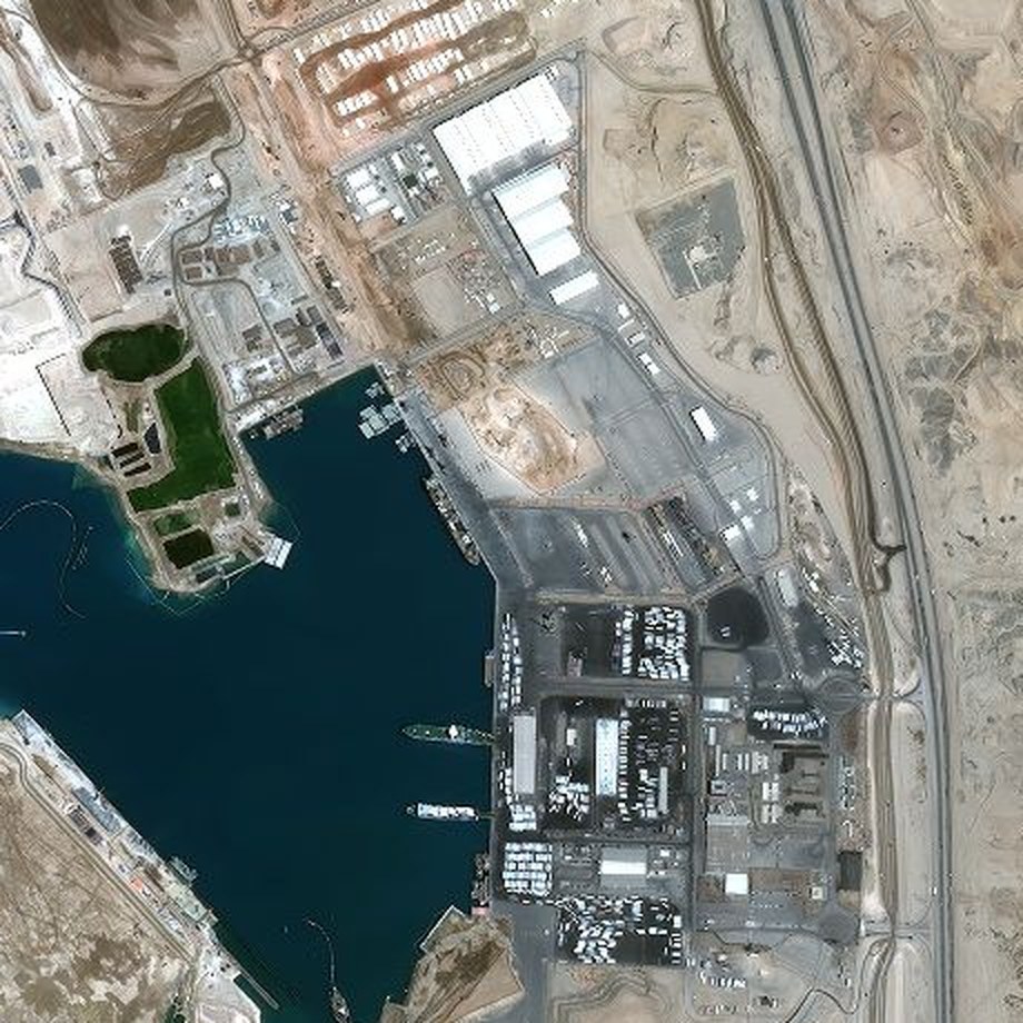
Very-high-resolution imagery of a port and industrial zone on the Red Sea coast. Switch layers to see how one orbit view informs three different risk questions.
Illustrative overlays, not an assessment
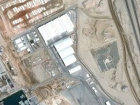
Virtrix measures roof area, the gap to each neighbouring building and how close open storage sits to the walls. Every measurement shows its image date and accuracy, and becomes a focused question for the engineer, not a score.
Pléiades © CNES 2024, Distribution Airbus DS. Image published by Airbus; shown for illustration only. Virtrix is not affiliated with the site owner.
You send a list of insured sites. You get back a dated, engineer-checked record for each one that every team can use
Virtrix
For each site on your list, Virtrix uses recent licensed satellite imagery at 30 to 50 cm. It outlines the buildings, measures roof area and gaps to neighbours, and marks yards, access and nearby operations. An analyst checks every outline.
Virtrix, AI-assisted
AI-assisted analysis writes a site record: each measurement and its accuracy, the image source and date, what imagery cannot show, and the questions to check on site.
Your risk engineers
Your engineers take the record and its questions on survey. They confirm, correct or add to it, and their judgment is final.
Your insurance teams
Underwriting, portfolio and reinsurance teams work from the same checked record, with each fact traceable to its image and date.
Step 2 produces a record like this for every insured site. It says what the image shows, where it came from, what it cannot show, and what the engineer needs to check on site.
Questions for the engineer

Virtrix measures what the imagery shows, using AI assistance and an analyst check. It organises the evidence and points to what needs a closer look, across more sites than a team could review by hand. Engineers and underwriters check it, confirm it and make every decision. Each finding links back to the image and date it came from.
We are inviting a small group of Saudi & GCC insurers and risk partners to shape Virtrix on their own live and historical risks. Founding partners get early access, a direct say in the roadmap, and the first look at an orbit-to-decision workflow built for this market.
Places are limited to a small founding group
Share a few details and we will get back to you to discuss whether the founding pilot is a fit for your organisation
We will be in touch shortly to discuss the pilot.
Virtrix is a physical risk intelligence platform for property and casualty insurers. It tracks how risk is changing at every site you insure and across your portfolio. It combines dated satellite imagery, AI-assisted analysis and your engineers' review in one record per site, so underwriting, portfolio and reinsurance teams decide from the same facts.
A survey describes a site on one day. Virtrix keeps a dated record for each site and builds on it over time, so you can see what has changed, such as new buildings, outdoor storage or activity next door. Engineers' findings feed into that record; they are one input, not the product. In the pilot, each record is dated so it can be compared later; ongoing Change Monitoring is on the roadmap.
The same site records roll up across your book, so you can see where insured sites sit close together and could be hit by the same event. That helps you decide where to accept more risk and how much reinsurance to buy. The Concentration & Accumulation module is in development. It works from your own schedule of insured locations.
Roof area, the gap between buildings, how close open storage sits to the walls, access around the site, and the distance to nearby hazardous operations. Each measurement shows the image date and its accuracy. Measurements raise questions for your engineer; they never change a score on their own.
Roof and wall materials, fire walls inside the building, sprinklers and water supply, and what is inside packaging or under covers. These are always checked by your engineer on site.
No. Virtrix shows engineers what has changed and what to check before they go on site. Their judgment is final on every finding, and the record shows who confirmed what. Remote measurements narrow what the engineer checks. Values close to a limit are always measured on site.
Fire is in the pilot now. Concentration & Accumulation is in development. Flood & Weather, Change Monitoring, Exposure Data Quality and Reinsurance & Capital Insight are on the roadmap.
A defined set of your sites, mixing historical cases with live ones, a short series of feedback sessions with our team, and no upfront investment. Scope and timing are agreed with each partner, and the pilot terms apply.
A list of the sites you want to test, with an address or coordinates, occupancy and basic policy details. Past engineering reports help but are optional. We agree the scope, data format and confidentiality terms with you before the pilot starts.
Yes. Pilot data is handled under a mutual confidentiality agreement signed before any file is shared, and is used only for the agreed pilot work. See our privacy notice for how we handle personal data.